Chyngton Farm
Introduction
The photograph on this page of Chyngton Farm by Simon Carey as part of the Geograph project.
The Geograph project started in 2005 with the aim of publishing, organising and preserving representative images for every square kilometre of Great Britain, Ireland and the Isle of Man.

There are currently over 7.5m images from over 14,400 individuals and you can help contribute to the project by visiting https://www.geograph.org.uk
Chyngton Farm
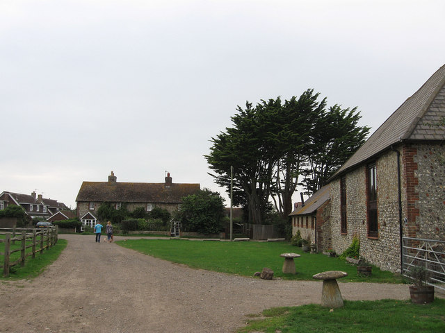
Image: © Simon Carey Taken: 29 Sep 2013
Chyngton was originally a small medieval settlement that shrank to little more than the farm by the early modern period. Being next to downland the decline of the village may well have been a mixture of economic, whereby arable farming was replaced by more the more lucrative and less labour intensive sheep farming, the various plagues that struck the country from the 14th century or the persistent destruction caused by the raiding French during the Hundred Years War. In view are a couple of former farm buildings that have been converted into dwellings, the barn on the right is now called Two Hoots, the byre beyond Barn Cottage. On Chyngton Lane are a couple of flint fronted former labourers cottages.
Images are licensed for reuse under creativecommons.org/licenses/by-sa/2.0
Image Location
Latitude
50.768305
Longitude
0.131585