Clayport Pant
Introduction
The photograph on this page of Clayport Pant by Russel Wills as part of the Geograph project.
The Geograph project started in 2005 with the aim of publishing, organising and preserving representative images for every square kilometre of Great Britain, Ireland and the Isle of Man.

There are currently over 7.5m images from over 14,400 individuals and you can help contribute to the project by visiting https://www.geograph.org.uk
Clayport Pant
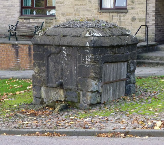
Image: © Russel Wills Taken: 30 Sep 2013
On the south side of Clayport, outside Westgate House. It is in the form of a large, squat pillar in local sandstone. There is an iron spout on the north side, with an inscribed panel above it, and the remains of a broken trough below. On the east side there are signs of repair, and remains of a metal bracket. On the west side there is a Wooden door fixed with screwed bars. The date at 1755 makes it the oldest pant in Alnwick. (St Michael's Pant dates from 1759).
Images are licensed for reuse under creativecommons.org/licenses/by-sa/2.0
Image Location
Latitude
55.411664
Longitude
-1.710777