The Salutation, Higher Chatham Street Manchester
Introduction
The photograph on this page of The Salutation, Higher Chatham Street Manchester by Stephen Richards as part of the Geograph project.
The Geograph project started in 2005 with the aim of publishing, organising and preserving representative images for every square kilometre of Great Britain, Ireland and the Isle of Man.

There are currently over 7.5m images from over 14,400 individuals and you can help contribute to the project by visiting https://www.geograph.org.uk
The Salutation, Higher Chatham Street Manchester
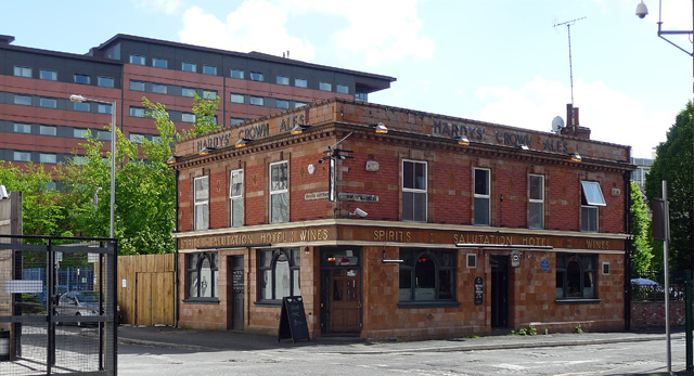
Image: © Stephen Richards Taken: 14 May 2012
On the corner of Boundary Street. Victorian or Edwardian, glazed tiles below, brick above. When I studied maths at the University of Manchester in 1985-88, this was the mathematicians' pub or so we were told. We had to calculate our own bills and sit on chairs based on conic sections (or that could have been poor workmanship). It was then slightly isolated among empty patches of grass, all of which have since been built on by the university.
Images are licensed for reuse under creativecommons.org/licenses/by-sa/2.0
Image Location
Latitude
53.468508
Longitude
-2.239328