Milestone with benchmark outside #196 London Road
Introduction
The photograph on this page of Milestone with benchmark outside #196 London Road by Roger Templeman as part of the Geograph project.
The Geograph project started in 2005 with the aim of publishing, organising and preserving representative images for every square kilometre of Great Britain, Ireland and the Isle of Man.

There are currently over 7.5m images from over 14,400 individuals and you can help contribute to the project by visiting https://www.geograph.org.uk
Milestone with benchmark outside #196 London Road
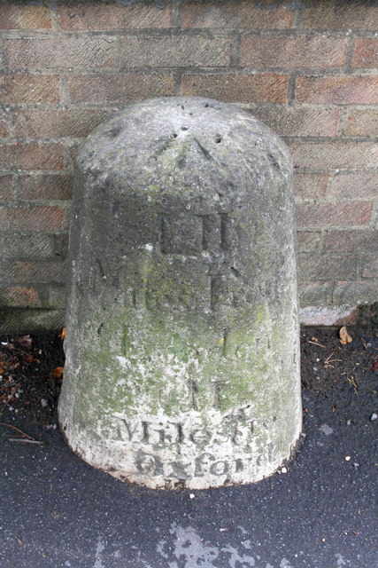
Image: © Roger Templeman Taken: 18 Sep 2013
The milestone indicates LII (52) miles from London and II (2) miles to Oxford. It is shown on the 1880 1:2500 map of Oxfordshire. On top of the stone is an OS rivet benchmark which is described on the Bench Mark Database at http://www.bench-marks.org.uk/bm51483
Images are licensed for reuse under creativecommons.org/licenses/by-sa/2.0
Image Location
Latitude
51.761432
Longitude
-1.206083