Plaque on Downside Bridge
Introduction
The photograph on this page of Plaque on Downside Bridge by Bikeboy as part of the Geograph project.
The Geograph project started in 2005 with the aim of publishing, organising and preserving representative images for every square kilometre of Great Britain, Ireland and the Isle of Man.

There are currently over 7.5m images from over 14,400 individuals and you can help contribute to the project by visiting https://www.geograph.org.uk
Plaque on Downside Bridge
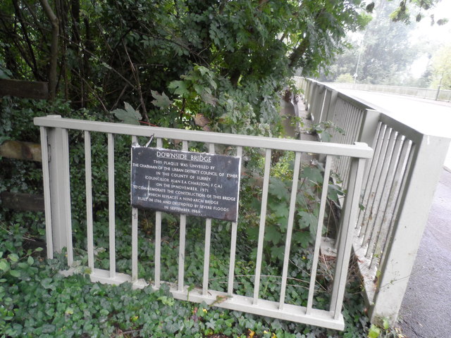
Image: © Bikeboy Taken: 14 Sep 2013
It reads: "This plaque was unveiled by the chairman of the Urban District Council of Esher in the County of Surrey (Councillor Alan E.A. Charlton F.C.A.) on the 1st November 1971 to commemorate the construction of this bridge which replaces a nine-arch bridge built in 1786 and destroyed by severe floods in September 1968." See http://www.francisfrith.com/cobham,surrey/photos/dowunveilednside-bridge-1903_49278/#utmcsr=google.co.uk&utmcmd=referral&utmccn=google.co.uk for a picture of the old bridge. See http://www.cobhamheritage.org.uk/index.php/down-memory-lane?start=4 for an account of the floods.
Images are licensed for reuse under creativecommons.org/licenses/by-sa/2.0
Image Location
Latitude
51.323391
Longitude
-0.412713