Covert Way
Introduction
The photograph on this page of Covert Way by Martin Addison as part of the Geograph project.
The Geograph project started in 2005 with the aim of publishing, organising and preserving representative images for every square kilometre of Great Britain, Ireland and the Isle of Man.

There are currently over 7.5m images from over 14,400 individuals and you can help contribute to the project by visiting https://www.geograph.org.uk
Covert Way
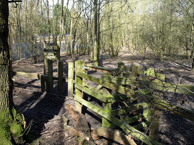
Image: © Martin Addison Taken: 16 Mar 2007
Covert Way is a local nature reserve to the south of Hadley Wood. A fence forms the boundary with Monken Hadley Common. There are several gates like this one to allow the free passage of walkers. The Kings Cross main line is visible through the trees.
Images are licensed for reuse under creativecommons.org/licenses/by-sa/2.0
Image Location
Latitude
51.660105
Longitude
-0.174413