Cwm Tywi seen from Coed Nantyrhwch, Powys
Introduction
The photograph on this page of Cwm Tywi seen from Coed Nantyrhwch, Powys by Roger D Kidd as part of the Geograph project.
The Geograph project started in 2005 with the aim of publishing, organising and preserving representative images for every square kilometre of Great Britain, Ireland and the Isle of Man.

There are currently over 7.5m images from over 14,400 individuals and you can help contribute to the project by visiting https://www.geograph.org.uk
Cwm Tywi seen from Coed Nantyrhwch, Powys
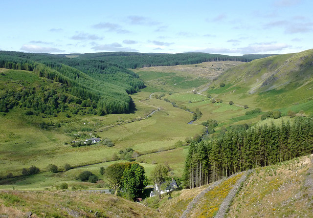
Image: © Roger D Kidd Taken: 23 Sep 2013
This is the glorious view from the forestry road above the house at Nantyrhwch. Dolgoch hostel on the far side of the Afon Tywi. Note that the bridleway leading south (left) from Dolgoch barely exists, and is not a route I recommend, especially for bike riders. The felling of the trees here was during 2011 and 2012. Part of the massive Tywi Forest is on the far side of the river, in Cerdigion. The mountain road (former drover's road) between Abergwesyn and Tregaron can be seen on the right, single track, only surfaced in the 1960s (I think) and impassable in icy weather.
Images are licensed for reuse under creativecommons.org/licenses/by-sa/2.0
Image Location
Latitude
52.189069
Longitude
-3.743802