Grand Union Canal: Bridge Number 80A
Introduction
The photograph on this page of Grand Union Canal: Bridge Number 80A by Nigel Cox as part of the Geograph project.
The Geograph project started in 2005 with the aim of publishing, organising and preserving representative images for every square kilometre of Great Britain, Ireland and the Isle of Man.

There are currently over 7.5m images from over 14,400 individuals and you can help contribute to the project by visiting https://www.geograph.org.uk
Grand Union Canal: Bridge Number 80A
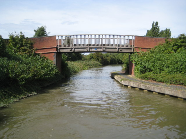
Image: © Nigel Cox Taken: 1 Sep 2013
Bridge Number 80A is a footbridge linking the Downhead Park and Willen Park areas of Milton Keynes. Incidentally there is no Bridge Number 80 any more. This number was originally allocated to a long demolished (prior to Milton Keynes being built) swing bridge just to the north of where the entrance to the Pennyland Boat Basin is today. Curiously its location was between where Image and Image are today. If precedent elsewhere on the Grand Union Canal had been followed the latter should have been numbered Bridge Number 80.
Images are licensed for reuse under creativecommons.org/licenses/by-sa/2.0
Image Location
Latitude
52.058525
Longitude
-0.735691