
Grand Union Canal: Bridge Number 76A
Introduction
The photograph on this page of Grand Union Canal: Bridge Number 76A by Nigel Cox as part of the Geograph project.
The Geograph project started in 2005 with the aim of publishing, organising and preserving representative images for every square kilometre of Great Britain, Ireland and the Isle of Man.

There are currently over 7.5m images from over 14,400 individuals and you can help contribute to the project by visiting https://www.geograph.org.uk
Grand Union Canal: Bridge Number 76A
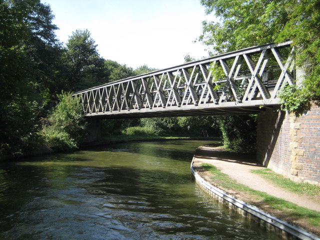
Image: © Nigel Cox Taken: 1 Sep 2013
Bridge Number 76A was built by the London & North Western Railway in 1867 on the route of their branch line from Wolverton to Newport Pagnell. The railway was a victim of Dr Beeching and closed to passenger traffic in 1964 and to goods trains in 1967 after 100 years of service. Old Ordnance Survey maps show that there was a railway milepost at the right end of the bridge here inscribed Newport Pagnell 2. The bridge has been retained to carry a footpath over the canal, and this now forms a section of the long distance Midshires Way.
Images are licensed for reuse under creativecommons.org/licenses/by-sa/2.0
Image Location

Latitude
52.072235
Longitude
-0.765214