Gas Street, Canterbury
Introduction
The photograph on this page of Gas Street, Canterbury by Elliott Simpson as part of the Geograph project.
The Geograph project started in 2005 with the aim of publishing, organising and preserving representative images for every square kilometre of Great Britain, Ireland and the Isle of Man.

There are currently over 7.5m images from over 14,400 individuals and you can help contribute to the project by visiting https://www.geograph.org.uk
Gas Street, Canterbury
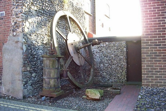
Image: © Elliott Simpson Taken: 16 Feb 2006
Part of the stationary engine used on an incline on the Canterbury - Whitstable railway in the 1830s - presently located behind the castle in Gas Street I was informed that this photo was used to help persuade the local authority to take the historic cylinder into care. A later photo - https://www.geograph.org.uk/photo/5030348 - shows that it is no longer there.
Images are licensed for reuse under creativecommons.org/licenses/by-sa/2.0
Image Location
Latitude
51.275791
Longitude
1.074421