Newhall Bridge
Introduction
The photograph on this page of Newhall Bridge by Graham Hogg as part of the Geograph project.
The Geograph project started in 2005 with the aim of publishing, organising and preserving representative images for every square kilometre of Great Britain, Ireland and the Isle of Man.

There are currently over 7.5m images from over 14,400 individuals and you can help contribute to the project by visiting https://www.geograph.org.uk
Newhall Bridge
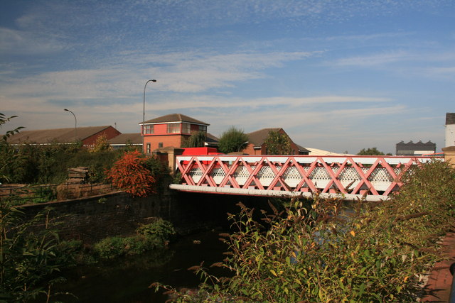
Image: © Graham Hogg Taken: 24 Sep 2013
Viewed from the Five Weirs Walk. The bridge dates from 1888 and was originally a link between separate parts of the grounds of Attercliffe New Hall. The first bridge on this site was built around 1780 and named Swallow Bridge after the owner of the Hall and the Attercliffe Forges. The redbrick building beyond the bridge is Riverside Court, which was where I worked in the 1990s.
Images are licensed for reuse under creativecommons.org/licenses/by-sa/2.0
Image Location
Latitude
53.39792
Longitude
-1.432686