Cross Country Service
Introduction
The photograph on this page of Cross Country Service by Martin Addison as part of the Geograph project.
The Geograph project started in 2005 with the aim of publishing, organising and preserving representative images for every square kilometre of Great Britain, Ireland and the Isle of Man.

There are currently over 7.5m images from over 14,400 individuals and you can help contribute to the project by visiting https://www.geograph.org.uk
Cross Country Service
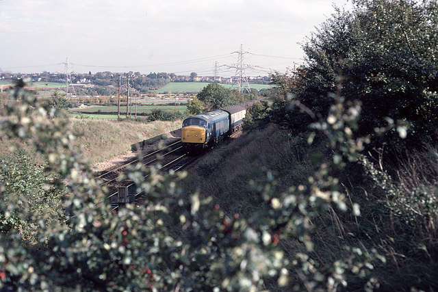
Image: © Martin Addison Taken: Unknown
Class 46, 46007, hurries towards Bristol with a train from the midlands. In the distance, seen across the farmland, the traffic on the M4 is visible. The high-tension powerlines in the photo connect to the substation at Lower Lark's Farm some distance to the north.
Images are licensed for reuse under creativecommons.org/licenses/by-sa/2.0
Image Location


Leaflet Map data © OpenStreetMap
Latitude
51.514405
Longitude
-2.527673