
The "Red Hall" site, Belfast (1)
Introduction
The photograph on this page of The "Red Hall" site, Belfast (1) by Albert Bridge as part of the Geograph project.
The Geograph project started in 2005 with the aim of publishing, organising and preserving representative images for every square kilometre of Great Britain, Ireland and the Isle of Man.

There are currently over 7.5m images from over 14,400 individuals and you can help contribute to the project by visiting https://www.geograph.org.uk
The "Red Hall" site, Belfast (1)
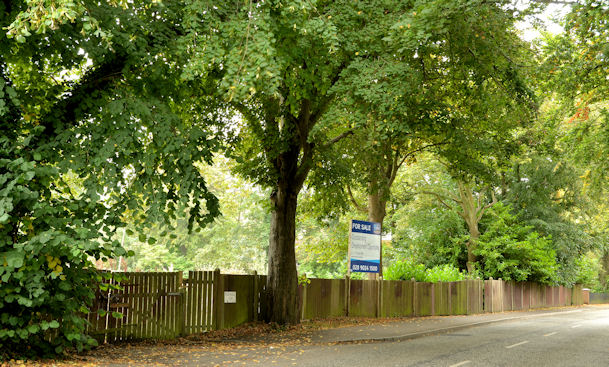
Image: © Albert Bridge Taken: 25 Sep 2013
A cleared site of 1.14 acres, on the eastern side of the Circular Road (no 109) between Strathearn Park and the Cairnburn Road, offered for sale and described by the agents as having the following planning permissions: “Application No: Z/2007/2782/f – Residential development comprising 20 two bed apartments and 2 townhouses and basement parking Approved 23rd April 2009. Application No: Z/2011/0450/f – Erection of a new 55 bed 2 storey residential EMI/Nursing Care Home with partial semi-basement parking and facility area. Approved 19th December 2011. Application No: Z/2012/1018/F – Proposed nursing home with associated car parking and landscaping. Approved 8th February 2013”. Continue to Image This series of photographs appears as a matter of geographical and historical record only. I have no connection with any of the parties involved in the sale.
Images are licensed for reuse under creativecommons.org/licenses/by-sa/2.0
Image Location

Latitude
54.606875
Longitude
-5.859471