78-90 Camberwell New Road
Introduction
The photograph on this page of 78-90 Camberwell New Road by Stephen Richards as part of the Geograph project.
The Geograph project started in 2005 with the aim of publishing, organising and preserving representative images for every square kilometre of Great Britain, Ireland and the Isle of Man.

There are currently over 7.5m images from over 14,400 individuals and you can help contribute to the project by visiting https://www.geograph.org.uk
78-90 Camberwell New Road
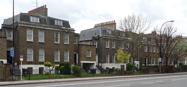
Image: © Stephen Richards Taken: 21 Apr 2012
All early or mid-C19th, maybe 1830-1840, comprising two pairs of linked houses and a short terrace. Two bays and two storeys over a basement, mansard roofs. Grade II listed.
Images are licensed for reuse under creativecommons.org/licenses/by-sa/2.0
Image Location
Latitude
51.479549
Longitude
-0.107033