Manchester: view down the Irwell and across to Salford
Introduction
The photograph on this page of Manchester: view down the Irwell and across to Salford by Christopher Hilton as part of the Geograph project.
The Geograph project started in 2005 with the aim of publishing, organising and preserving representative images for every square kilometre of Great Britain, Ireland and the Isle of Man.

There are currently over 7.5m images from over 14,400 individuals and you can help contribute to the project by visiting https://www.geograph.org.uk
Manchester: view down the Irwell and across to Salford
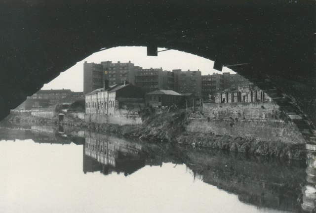
Image: © Christopher Hilton Taken: Unknown
On the far bank, extreme left of the photo, can be seen a bridge which now, with many years' hindsight, I suspect may be the end of the disused Manchester, Bolton & Bury Canal. Local knowledge would need to confirm that. Date of this is uncertain but I would guess December 1982; certainly within 12 months either side of that date.
Images are licensed for reuse under creativecommons.org/licenses/by-sa/2.0
Image Location
Latitude
53.483499
Longitude
-2.248755