Monmouth Priory
Introduction
The photograph on this page of Monmouth Priory by Philip Halling as part of the Geograph project.
The Geograph project started in 2005 with the aim of publishing, organising and preserving representative images for every square kilometre of Great Britain, Ireland and the Isle of Man.

There are currently over 7.5m images from over 14,400 individuals and you can help contribute to the project by visiting https://www.geograph.org.uk
Monmouth Priory
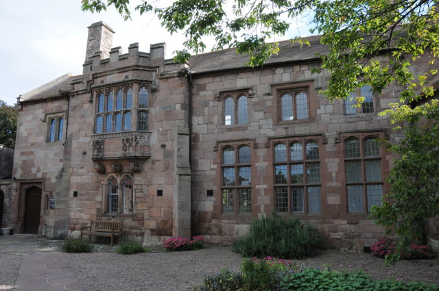
Image: © Philip Halling Taken: 21 Sep 2013
Monmouth Priory was found around 1080 as a Benedictine Priory. The priory continued until the Dissolution in 1536. Between 1814 and 1971 the surviving building was used as a primary school. I recall staying here in the spring of 1987 when it was a Youth Hostel.
Images are licensed for reuse under creativecommons.org/licenses/by-sa/2.0
Image Location
Latitude
51.81355
Longitude
-2.714083