Thorverton : Acorn Cottage
Introduction
The photograph on this page of Thorverton : Acorn Cottage by Lewis Clarke as part of the Geograph project.
The Geograph project started in 2005 with the aim of publishing, organising and preserving representative images for every square kilometre of Great Britain, Ireland and the Isle of Man.

There are currently over 7.5m images from over 14,400 individuals and you can help contribute to the project by visiting https://www.geograph.org.uk
Thorverton : Acorn Cottage
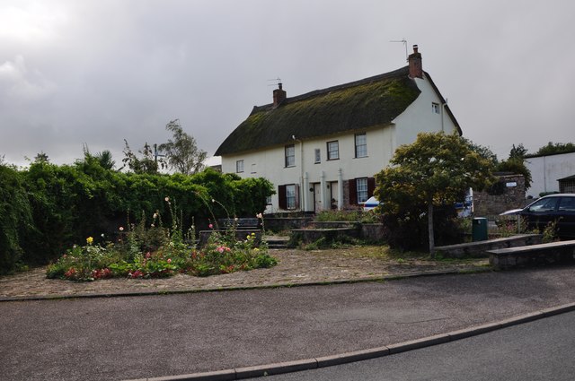
Image: © Lewis Clarke Taken: 16 Sep 2013
GV II House and adjoining cottage, formerly 1 build. Probably C18, C20 renovations. Unusual materials of construction : a photograph of the front elevation of Acorn Cottage with the render stripped off shows local stone rubble up to approximately first floor level, this acts as a plinth for a frame of timber studs infilled with cob bricks; the rest of the range may be constructed in the same way; Acorn Cottage has an internal framed partition wall, with cob brick infill and part, at least, of the axial stack of Acorn House is also of cob bricks.
Images are licensed for reuse under creativecommons.org/licenses/by-sa/2.0
Image Location
Latitude
50.808189
Longitude
-3.526228