Park Drive, Bangor
Introduction
The photograph on this page of Park Drive, Bangor by Albert Bridge as part of the Geograph project.
The Geograph project started in 2005 with the aim of publishing, organising and preserving representative images for every square kilometre of Great Britain, Ireland and the Isle of Man.

There are currently over 7.5m images from over 14,400 individuals and you can help contribute to the project by visiting https://www.geograph.org.uk
Park Drive, Bangor
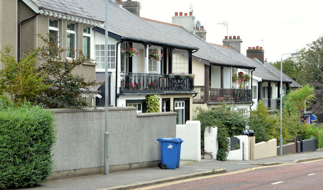
Image: © Albert Bridge Taken: 17 Sep 2013
A short street, between the Hamilton Road and Castle Street, laid out around 1920. Most of the houses in the photograph are said to date from about 1925 and feature balconies, verandahs and fancy cast ironwork.
Images are licensed for reuse under creativecommons.org/licenses/by-sa/2.0
Image Location
Latitude
54.659955
Longitude
-5.663872