Mansfield, Notts.
Introduction
The photograph on this page of Mansfield, Notts. by David Hallam-Jones as part of the Geograph project.
The Geograph project started in 2005 with the aim of publishing, organising and preserving representative images for every square kilometre of Great Britain, Ireland and the Isle of Man.

There are currently over 7.5m images from over 14,400 individuals and you can help contribute to the project by visiting https://www.geograph.org.uk
Mansfield, Notts.
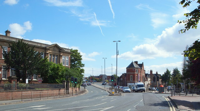
Image: © David Hallam-Jones Taken: 13 Sep 2013
Chesterfield Road South (the A6009) at the foot of this picture becomes St Peter's Way (also the A6009) as it curves away to the left. An entrance or exit point into - or out of - Westgate (one of the town's main, pedestrianised shopping streets) is situated behind the white van. The Chesterfield Road campus building of the West Notts College - dating from 1928 - stands proudly on the left. This site provides facilities and educational opportunities for students studying fashion, art & design, and graphic design. It is also the college's ESOL (English For Speakers of Other Languages) base.
Images are licensed for reuse under creativecommons.org/licenses/by-sa/2.0
Image Location
Latitude
53.147593
Longitude
-1.199902