Monkey Island, Dorney Reach from the air
Introduction
The photograph on this page of Monkey Island, Dorney Reach from the air by Stephen Williams as part of the Geograph project.
The Geograph project started in 2005 with the aim of publishing, organising and preserving representative images for every square kilometre of Great Britain, Ireland and the Isle of Man.

There are currently over 7.5m images from over 14,400 individuals and you can help contribute to the project by visiting https://www.geograph.org.uk
Monkey Island, Dorney Reach from the air
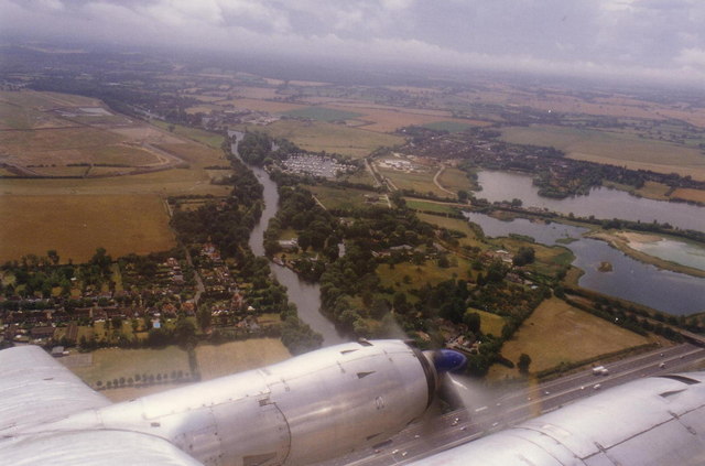
Image: © Stephen Williams Taken: 29 Jul 1996
Monkey Island is the area bordered by the M4, the Thames and the lakes. Dorney Reach is the built-up area on the left. This was taken from a Vickers Viscount during a flight in 1996 to commemorate the type's retirement from commercial service.
Images are licensed for reuse under creativecommons.org/licenses/by-sa/2.0
Image Location
Latitude
51.503841
Longitude
-0.686983