Tilbury docks from the air
Introduction
The photograph on this page of Tilbury docks from the air by Stephen Williams as part of the Geograph project.
The Geograph project started in 2005 with the aim of publishing, organising and preserving representative images for every square kilometre of Great Britain, Ireland and the Isle of Man.

There are currently over 7.5m images from over 14,400 individuals and you can help contribute to the project by visiting https://www.geograph.org.uk
Tilbury docks from the air
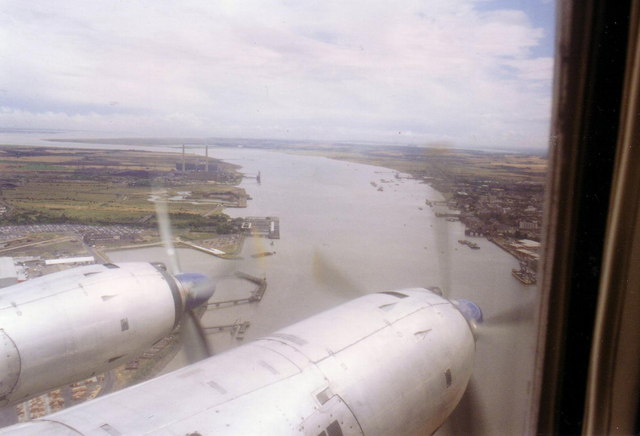
Image: © Stephen Williams Taken: 29 Jul 1996
The large jetty in the centre of this view is Tilbury passenger terminal. The docks are just before it, Tilbury fort just beyond and Tilbury B power station's chimneys are in the distance. This was taken from a Vickers Viscount during a scenic flight in 1996 to commemorate the type's retirement from commercial service.
Images are licensed for reuse under creativecommons.org/licenses/by-sa/2.0
Image Location
Latitude
51.450936
Longitude
0.364303