Stang Foot
Introduction
The photograph on this page of Stang Foot by Oliver Dixon as part of the Geograph project.
The Geograph project started in 2005 with the aim of publishing, organising and preserving representative images for every square kilometre of Great Britain, Ireland and the Isle of Man.

There are currently over 7.5m images from over 14,400 individuals and you can help contribute to the project by visiting https://www.geograph.org.uk
Stang Foot
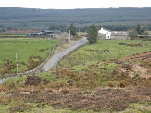
Image: © Oliver Dixon Taken: 13 Mar 2007
A farm much given over to horses at the foot of Stang Forest. The Stang is a formidable hill between the Greta Valley and Arkengarthdale. Stang is apparently a word taken from the Norse meaning a pole or a stake. Compare with Yorkshire dialect biggerstang (a builders' scaffold pole) and the Yorkshire folk custom of 'Riding the Stang' where a person to be upheld for public ridicule (especially for wife-beating) was placed astride a pole and carried around to the accompaniment of whistles and jeers. http://www.viking.no/e/england/e-viking_words_2.htm (Not sure this is entirely relevant, but is interesting in its own right).
Images are licensed for reuse under creativecommons.org/licenses/by-sa/2.0
Image Location
Latitude
54.481205
Longitude
-1.961537