Mansfield, Notts.
Introduction
The photograph on this page of Mansfield, Notts. by David Hallam-Jones as part of the Geograph project.
The Geograph project started in 2005 with the aim of publishing, organising and preserving representative images for every square kilometre of Great Britain, Ireland and the Isle of Man.

There are currently over 7.5m images from over 14,400 individuals and you can help contribute to the project by visiting https://www.geograph.org.uk
Mansfield, Notts.
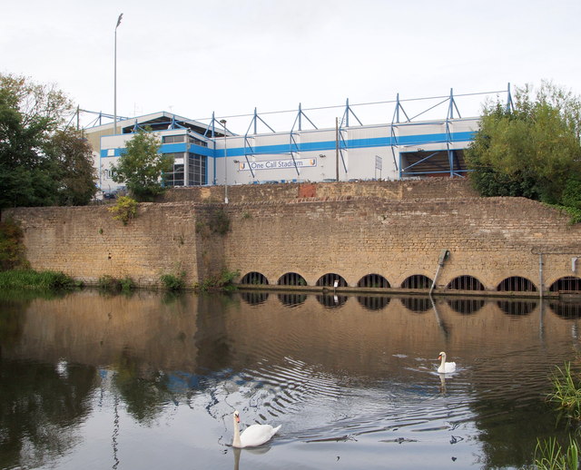
Image: © David Hallam-Jones Taken: 13 Sep 2013
Only a section of the mill pond wall and water intake conduits remain of a former mill that existed here. Field Mill was originally a corn mill that was later acquired by a Nottingham hosiery company for use as a cotton mill. Following its purchase the mill was adapted and upgraded and the mill pond increased in size. Thereafter spinning was conducted here between 1788-1812. Although the buildings were used for other purposes after its cotton spinning role ceased, the premises were eventually purchased by the local Council and finally demolished in the 1920s. The former mill pond, formed by the dammed River Maun, is now an angler's paradise and part of the Maun Valley trail. Mansfield Town Football Club's Field Mill ground providing a backdrop. Quarry Lane runs between the lower and the higher stone walls.
Images are licensed for reuse under creativecommons.org/licenses/by-sa/2.0
Image Location
Latitude
53.13743
Longitude
-1.199194