Thamesmead South Estate, Hartslock Drive
Introduction
The photograph on this page of Thamesmead South Estate, Hartslock Drive by Stephen Richards as part of the Geograph project.
The Geograph project started in 2005 with the aim of publishing, organising and preserving representative images for every square kilometre of Great Britain, Ireland and the Isle of Man.

There are currently over 7.5m images from over 14,400 individuals and you can help contribute to the project by visiting https://www.geograph.org.uk
Thamesmead South Estate, Hartslock Drive
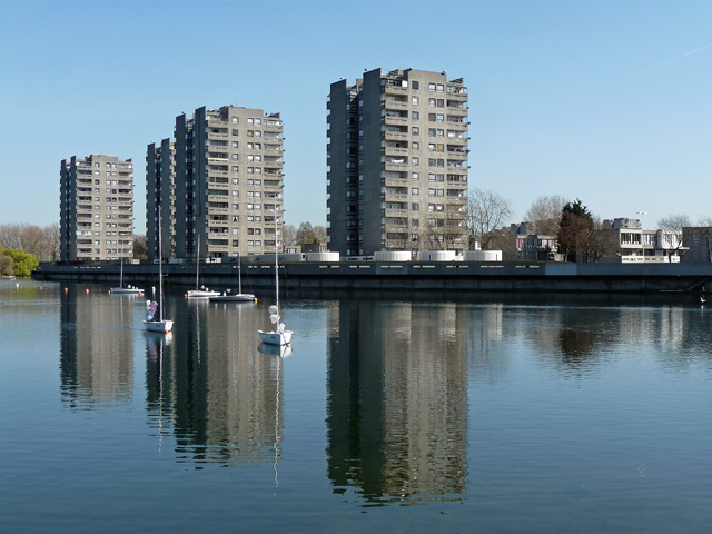
Image: © Stephen Richards Taken: 1 Apr 2012
Four towers by South Mere, the largest of the lakes, Thamesmead's most striking features. This was the first part of Thamesmead, originally conceived by the Greater London Council as a new town with a population up to 100,000, dating from 1967-72. A mixture of towers with elevated walkways and maisonettes and flats beyond. Even though the population has yet to reach 50,000, today, the unrelenting expanses of tired concrete and brick are hard to take. Lest we judge the original planners too harshly, Pevsner remarks that, "Thamesmead today bears little resemblance to the ideal community visualized by its begetters".
Images are licensed for reuse under creativecommons.org/licenses/by-sa/2.0
Image Location
Latitude
51.499226
Longitude
0.124885