River Misbourne Higher Denham
Introduction
The photograph on this page of River Misbourne Higher Denham by David Leeming as part of the Geograph project.
The Geograph project started in 2005 with the aim of publishing, organising and preserving representative images for every square kilometre of Great Britain, Ireland and the Isle of Man.

There are currently over 7.5m images from over 14,400 individuals and you can help contribute to the project by visiting https://www.geograph.org.uk
River Misbourne Higher Denham
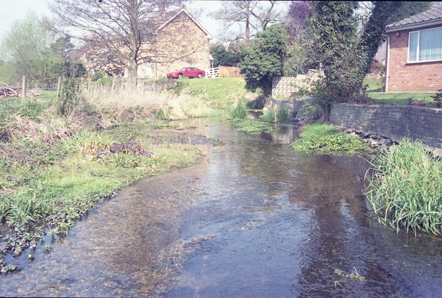
Image: © David Leeming Taken: 7 Apr 1997
View upstream near a minor road bridge crossing to a part of the Misbourne where the gardens of bank-side properties extend to the river edge, creating an unusual river corridor for this chalk stream. This part of the Misbourne is below the discharge point of Gerrards Cross sewage treatment works - which prevented the river drying out downstream during a period of acute low flows in late summer of 1997.
Images are licensed for reuse under creativecommons.org/licenses/by-sa/2.0
Image Location
Latitude
51.578437
Longitude
-0.517713