Portland Harbour
Introduction
The photograph on this page of Portland Harbour by John Stephen as part of the Geograph project.
The Geograph project started in 2005 with the aim of publishing, organising and preserving representative images for every square kilometre of Great Britain, Ireland and the Isle of Man.

There are currently over 7.5m images from over 14,400 individuals and you can help contribute to the project by visiting https://www.geograph.org.uk
Portland Harbour
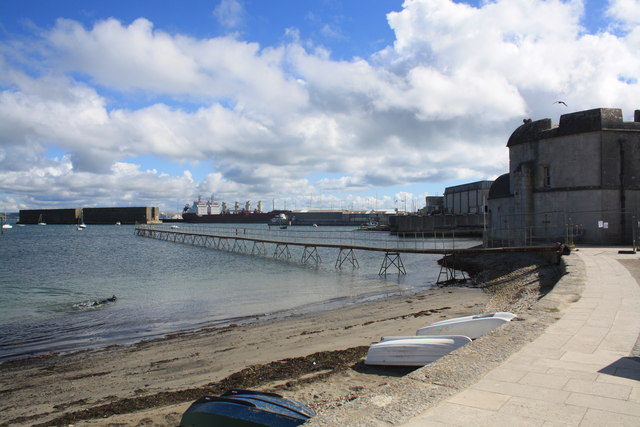
Image: © John Stephen Taken: 7 Sep 2013
View of Portland Harbour from the slips between the castle and sailing academy. From right to left: Entry to the flimsy looking pier for boats has been blocked off for safety reasons; the path is part of the coast path and cycle route and turns to the right to skirt the Castle; the oblong modern building to the left of the castle is the sports/leisure centre; the commercial port is centre with two 4 year old Maltese registered cargo/bulk carriers the Seleina and Sarine 7300t DWT, laid up or awaiting orders, whilst the two "Phoenix" Mulberry Harbour units look immoveable as ever on the far left.
Images are licensed for reuse under creativecommons.org/licenses/by-sa/2.0
Image Location
Latitude
50.569309
Longitude
-2.444036