Castle Combe - The Malthouse
Introduction
The photograph on this page of Castle Combe - The Malthouse by Rob Farrow as part of the Geograph project.
The Geograph project started in 2005 with the aim of publishing, organising and preserving representative images for every square kilometre of Great Britain, Ireland and the Isle of Man.

There are currently over 7.5m images from over 14,400 individuals and you can help contribute to the project by visiting https://www.geograph.org.uk
Castle Combe - The Malthouse
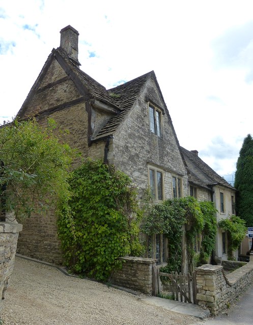
Image: © Rob Farrow Taken: 8 Sep 2013
The Malthouse in Castle Combe dates originally from the C16th with alterations from the next two centuries. Like many other houses and cottages in the village it is EH Grade II listed - see listing here http://list.english-heritage.org.uk/resultsingle.aspx?uid=1199090&searchtype=mapsearch
Images are licensed for reuse under creativecommons.org/licenses/by-sa/2.0
Image Location
Latitude
51.49352
Longitude
-2.228689