Alton West Estate, Highcliffe Drive
Introduction
The photograph on this page of Alton West Estate, Highcliffe Drive by Stephen Richards as part of the Geograph project.
The Geograph project started in 2005 with the aim of publishing, organising and preserving representative images for every square kilometre of Great Britain, Ireland and the Isle of Man.

There are currently over 7.5m images from over 14,400 individuals and you can help contribute to the project by visiting https://www.geograph.org.uk
Alton West Estate, Highcliffe Drive
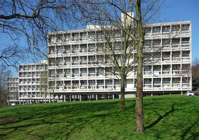
Image: © Stephen Richards Taken: 26 Mar 2012
One of the most highly regarded post-war housing estates, chiefly due to the variation in building types, landscaping and the generous allowance made for green space. The London County Council began planning in 1951 (chief architect Robert Matthew). Alton East came first, Alton West from 1954. Seen here are three of its landmark group of five slabs atop Downshire Field. They bear more than a passing resemblance to Le Corbusier's Unite d'Habitation in Marseilles. Flats recessed behind a grid, the block standing on pilotis (Image]). Pevsner attributes the development of this type of design to LCC architects W.J. Howell and Colin St John Wilson. Grade II* listed.
Images are licensed for reuse under creativecommons.org/licenses/by-sa/2.0
Image Location
Latitude
51.453482
Longitude
-0.246573