Former Rhyd-y-Blew Inn, Beaufort
Introduction
The photograph on this page of Former Rhyd-y-Blew Inn, Beaufort by Jaggery as part of the Geograph project.
The Geograph project started in 2005 with the aim of publishing, organising and preserving representative images for every square kilometre of Great Britain, Ireland and the Isle of Man.

There are currently over 7.5m images from over 14,400 individuals and you can help contribute to the project by visiting https://www.geograph.org.uk
Former Rhyd-y-Blew Inn, Beaufort
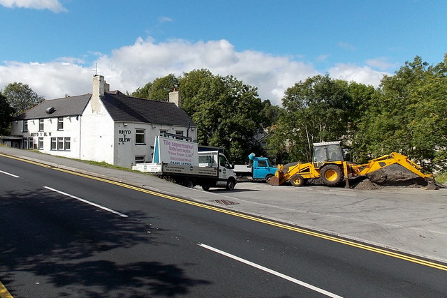
Image: © Jaggery Taken: 10 Sep 2013
Viewed across the A4047. One source states that the Rhyd-y-Blew was formerly a drovers' inn, and a hunting lodge used by the Duke of Beaufort. What fate awaits the closed pub now?
Images are licensed for reuse under creativecommons.org/licenses/by-sa/2.0
Image Location
Latitude
51.796108
Longitude
-3.217421