The Old Forge
Introduction
The photograph on this page of The Old Forge by Alan Murray-Rust as part of the Geograph project.
The Geograph project started in 2005 with the aim of publishing, organising and preserving representative images for every square kilometre of Great Britain, Ireland and the Isle of Man.

There are currently over 7.5m images from over 14,400 individuals and you can help contribute to the project by visiting https://www.geograph.org.uk
The Old Forge
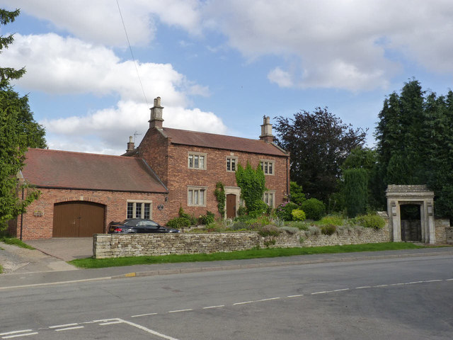
Image: © Alan Murray-Rust Taken: 21 Aug 2013
Dated 1794 on a datestone http://www.geograph.org.uk/photo/3647078 above the central window. The garage extension is 20th century but well matched to the original house. Listed Grade II. The gateway at the right dates from the early 19th century - probably under Gregory Gregory - and is separately listed Grade II.
Images are licensed for reuse under creativecommons.org/licenses/by-sa/2.0
Image Location
Latitude
52.883047
Longitude
-0.685983