Sneinton: Dale Street
Introduction
The photograph on this page of Sneinton: Dale Street by John Sutton as part of the Geograph project.
The Geograph project started in 2005 with the aim of publishing, organising and preserving representative images for every square kilometre of Great Britain, Ireland and the Isle of Man.

There are currently over 7.5m images from over 14,400 individuals and you can help contribute to the project by visiting https://www.geograph.org.uk
Sneinton: Dale Street
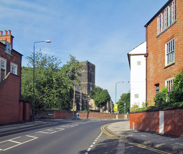
Image: © John Sutton Taken: 4 Sep 2013
St Stephen's Church is on the crest of the hill. The house on the right, on the corner of Belvoir Hill, has a large frameknitter's window on the top floor and dates from the time when net and hosiery making was a cottage industry. It has outlived a lot of the Victorian tenement factories built to supersede it.
Images are licensed for reuse under creativecommons.org/licenses/by-sa/2.0
Image Location
Latitude
52.951049
Longitude
-1.130601