Kingford Bridge
Introduction
The photograph on this page of Kingford Bridge by David Brinicombe as part of the Geograph project.
The Geograph project started in 2005 with the aim of publishing, organising and preserving representative images for every square kilometre of Great Britain, Ireland and the Isle of Man.

There are currently over 7.5m images from over 14,400 individuals and you can help contribute to the project by visiting https://www.geograph.org.uk
Kingford Bridge
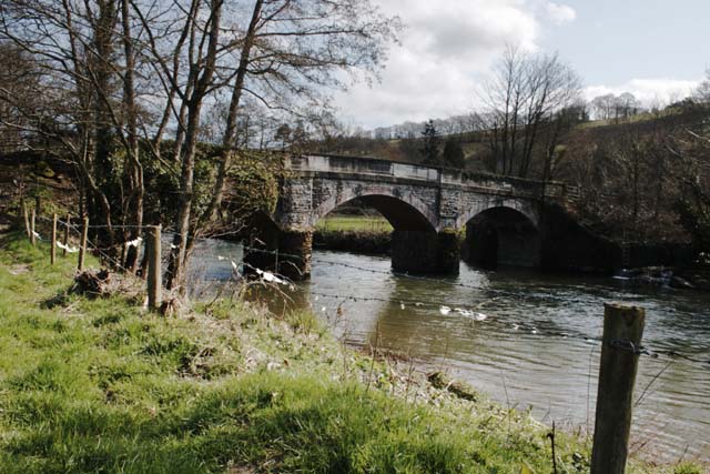
Image: © David Brinicombe Taken: 13 Mar 2007
Kingford bridge carries a narrow single track road over the River Taw. It was built by public subscription about a hundred years ago as there was a great need for another river crossing. The only alternative crossings still are at Umberleigh four miles North and Newnham Bridge near King's Nympton Station three and a half miles to the Southeast.
Images are licensed for reuse under creativecommons.org/licenses/by-sa/2.0
Image Location
Latitude
50.955731
Longitude
-3.961917