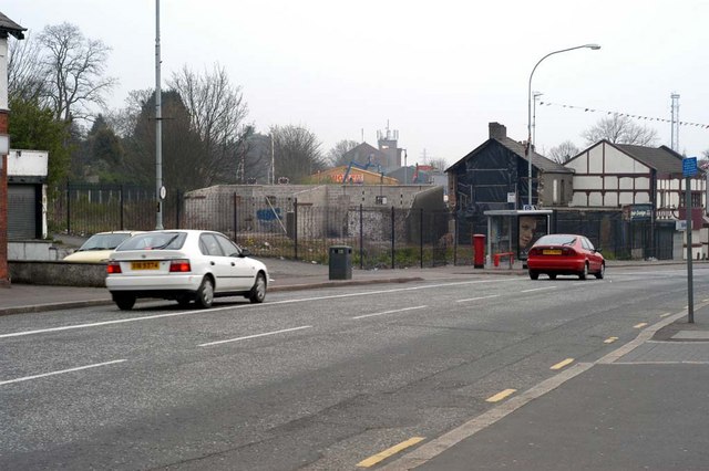
Kingsway, Dunmurry
Introduction
The photograph on this page of Kingsway, Dunmurry by Wilson Adams as part of the Geograph project.
The Geograph project started in 2005 with the aim of publishing, organising and preserving representative images for every square kilometre of Great Britain, Ireland and the Isle of Man.
There are currently over 7.5m images from over 14,400 individuals and you can help contribute to the project by visiting https://www.geograph.org.uk

Image: © Wilson Adams Taken: 13 Apr 2003
This image was made from the Seymour Hill end of Kingsway. Between the litter bin and bus shelter this was once a road that led up to Meetinghouse Level Crossing, downgraded to a pedestrian crossing in 1959, this leads to Ashley Park on the other side of the railway line. Behind the bus shelter there once stood a row of old houses converted to shops. These were demolished around 2002. Two of the original houses are still in place beside the Dunmurry Inn. These were demolished later. The old shops where replaced by a modern row of shops and apartments above them.

