Town Bridge, Bridgwater
Introduction
The photograph on this page of Town Bridge, Bridgwater by Jaggery as part of the Geograph project.
The Geograph project started in 2005 with the aim of publishing, organising and preserving representative images for every square kilometre of Great Britain, Ireland and the Isle of Man.

There are currently over 7.5m images from over 14,400 individuals and you can help contribute to the project by visiting https://www.geograph.org.uk
Town Bridge, Bridgwater
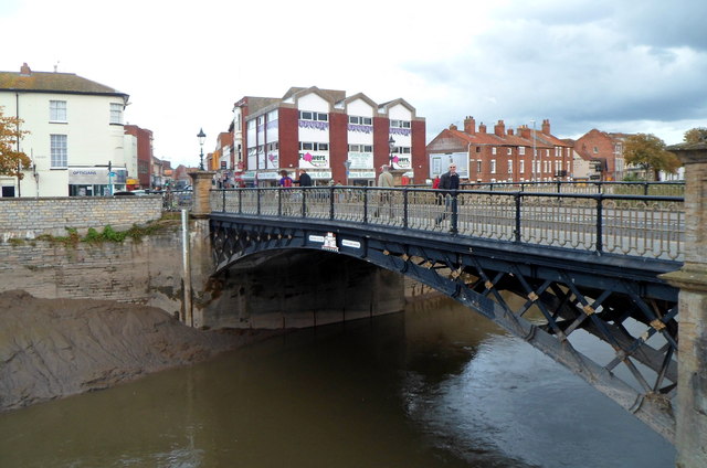
Image: © Jaggery Taken: 4 Oct 2012
Viewed across the River Parrett from West Quay. The bridge was erected in 1883, replacing its predecessor of 1795. Before that year, the exact nature of the river crossing here is unclear, though it must date back to ancient times. The Domesday Book (1086) records Bridgwater as Walter's Bridge, a reference to this location, which was the only road crossing of the river in the town until the 1960s. By that decade the volume of traffic was causing long delays at what had become a serious bottleneck.
Images are licensed for reuse under creativecommons.org/licenses/by-sa/2.0
Image Location
Latitude
51.128978
Longitude
-3.001005