Trunk route?
Introduction
The photograph on this page of Trunk route? by Stephen Craven as part of the Geograph project.
The Geograph project started in 2005 with the aim of publishing, organising and preserving representative images for every square kilometre of Great Britain, Ireland and the Isle of Man.

There are currently over 7.5m images from over 14,400 individuals and you can help contribute to the project by visiting https://www.geograph.org.uk
Trunk route?
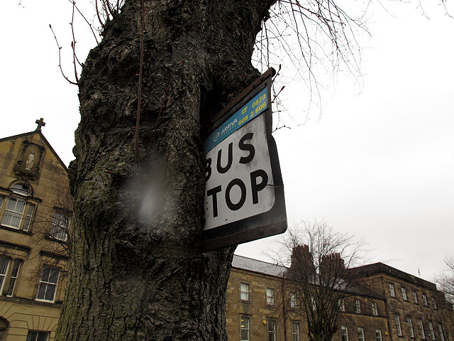
Image: © Stephen Craven Taken: 25 Apr 2013
This was not such a good idea – to fix a bus stop sign to a tree trunk that then grew around it. This is just outside the gates of Alnwick Castle. For context see Image
Images are licensed for reuse under creativecommons.org/licenses/by-sa/2.0
Image Location
Latitude
55.415883
Longitude
-1.709009