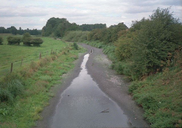
River Ver above St Albans during 1992 drought
Introduction
The photograph on this page of River Ver above St Albans during 1992 drought by David Leeming as part of the Geograph project.
The Geograph project started in 2005 with the aim of publishing, organising and preserving representative images for every square kilometre of Great Britain, Ireland and the Isle of Man.
There are currently over 7.5m images from over 14,400 individuals and you can help contribute to the project by visiting https://www.geograph.org.uk

Image: © David Leeming Taken: Unknown
This photo shows the Ver at the height of the 1989-92 groundwater drought period when it dried out as far downstream as Kingsbury Mill, St Albans. The narrow trickle of water shown originated a little upstream at Gorehambury where there was a semi-perennial discharge of urban run-off derived from Harpenden throughout the drought period. No natural flows from the chalk groundwater were possible until well below St Albans, towards Park Street, as the water table fell well below the riverbed. However, river flows were supported by a borehole discharge at Kingsbury Mill St Albans to maintain river amenity through Verulamium Park and further downstream. A later image taken in May 1994 at this location http://www.geograph.org.uk/photo/3630816 shows prolific beds of water starwort (Callitriche spp) following a strong recovery of river flows. The "groundwater drought" of 1989-92 was ended by the wet winters of 1992/93 and 1993/94 which recharged the chalk aquifer. Flows in the river were also improved after closure of the Friars Wash Pumping Station in late April 1993. This pumping station previously abstracted large volumes of groundwater near the head of the river, but this abstraction generally ceased after implementation of the River Ver Flow Alleviation of Low Flow Scheme (Ver ALF).

