Hele & Bradninch station (remains), 1995
Introduction
The photograph on this page of Hele & Bradninch station (remains), 1995 by Ben Brooksbank as part of the Geograph project.
The Geograph project started in 2005 with the aim of publishing, organising and preserving representative images for every square kilometre of Great Britain, Ireland and the Isle of Man.

There are currently over 7.5m images from over 14,400 individuals and you can help contribute to the project by visiting https://www.geograph.org.uk
Hele & Bradninch station (remains), 1995
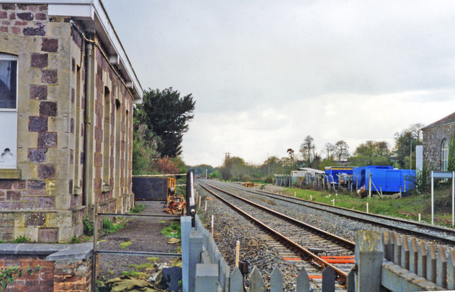
Image: © Ben Brooksbank Taken: 20 Apr 1995
View SW, towards Exeter, Plymouth and Penzance: ex-GWR (London, Bristol etc.) - Taunton - Exeter - Plymouth - Penzance main line. The station was closed to passengers 5/10/64 (to goods 17/5/65), but the line continues as the main line to the West Country - paralleling the M5 Motorway. (Cf. Image]).
Images are licensed for reuse under creativecommons.org/licenses/by-sa/2.0
Image Location
Latitude
50.811683
Longitude
-3.427833