Former pub in Hampton Hill High Street
Introduction
The photograph on this page of Former pub in Hampton Hill High Street by Stephen Williams as part of the Geograph project.
The Geograph project started in 2005 with the aim of publishing, organising and preserving representative images for every square kilometre of Great Britain, Ireland and the Isle of Man.

There are currently over 7.5m images from over 14,400 individuals and you can help contribute to the project by visiting https://www.geograph.org.uk
Former pub in Hampton Hill High Street
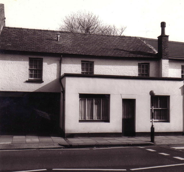
Image: © Stephen Williams Taken: Unknown
This building, close to and opposite the end of Windmill Road, was until 1913 a pub called the Brewery Tap, and nicknamed 'The Old Mud Hut'. When pictured in 1975 it was a private house, but not long after became a sports shop. I don't know what it is in use for today - perhaps somebody could enlighten me? If you have access to a copy of "The Birth and Growth of Hampton Hill" by Margery Orton and published in 1975, have a look at the picture of the pub taken about 1910.
Images are licensed for reuse under creativecommons.org/licenses/by-sa/2.0
Image Location
Latitude
51.425931
Longitude
-0.355941