The Church of St Andrew, Potterhanworth
Introduction
The photograph on this page of The Church of St Andrew, Potterhanworth by Dave Hitchborne as part of the Geograph project.
The Geograph project started in 2005 with the aim of publishing, organising and preserving representative images for every square kilometre of Great Britain, Ireland and the Isle of Man.

There are currently over 7.5m images from over 14,400 individuals and you can help contribute to the project by visiting https://www.geograph.org.uk
The Church of St Andrew, Potterhanworth
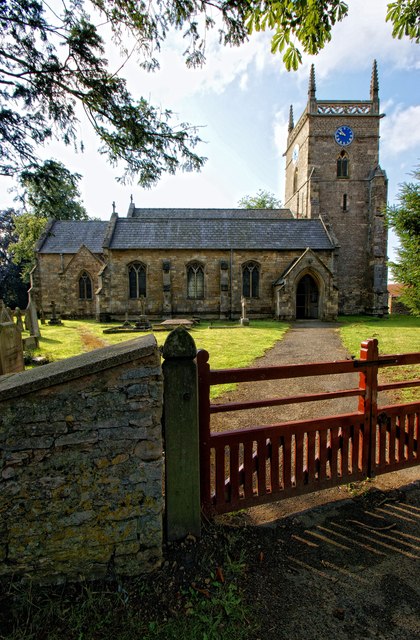
Image: © Dave Hitchborne Taken: 26 Aug 2013
A medieval tower, but the rest of the church was rebuilt 1856-7 to replace one of 1749. This church was first on the list to be photographed on this day. I had a bet that I could photograph more than thirty churches in one day (8 hours) and I did it comfortably and photographed thirty-two. I even managed to chat to a few kind people and photograph the inside of a working signal box. The day started quite a few miles from home (25 miles) and ended up a few more miles away at West Deeping (43 miles). I did around 58 route miles. The journey wasn't pre-planned, I just joined all the dots up that I'd stuck on my old 1½ inch to 1 mile Philips map, which denotes all the parish churches of Lincolnshire. The photographs I selected from the day - http://www.geograph.org.uk/search.php?i=43608058
Images are licensed for reuse under creativecommons.org/licenses/by-sa/2.0
Image Location
Latitude
53.181374
Longitude
-0.423085