Under the bridge
Introduction
The photograph on this page of Under the bridge by Richard Dorrell as part of the Geograph project.
The Geograph project started in 2005 with the aim of publishing, organising and preserving representative images for every square kilometre of Great Britain, Ireland and the Isle of Man.

There are currently over 7.5m images from over 14,400 individuals and you can help contribute to the project by visiting https://www.geograph.org.uk
Under the bridge
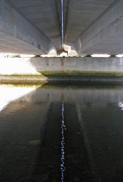
Image: © Richard Dorrell Taken: 26 Aug 2013
A footpath connecting Huntly Street and Huntly Place runs beneath Friar's Bridge on the west bank of the River Ness. The dual carriageway bridge carries the A82. It is actually two bridges, a couple of inches apart. I was fascinated by the dancing reflection of the gap in the rippled surface of the river, which of course, the camera catches as a still image.
Images are licensed for reuse under creativecommons.org/licenses/by-sa/2.0
Image Location
Latitude
57.481452
Longitude
-4.233934