
Shire Drain, near Tydd St Giles
Introduction
The photograph on this page of Shire Drain, near Tydd St Giles by David Prestidge as part of the Geograph project.
The Geograph project started in 2005 with the aim of publishing, organising and preserving representative images for every square kilometre of Great Britain, Ireland and the Isle of Man.

There are currently over 7.5m images from over 14,400 individuals and you can help contribute to the project by visiting https://www.geograph.org.uk
Shire Drain, near Tydd St Giles
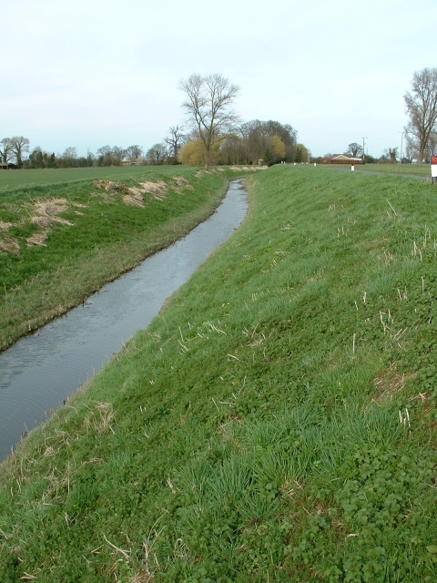
Image: © David Prestidge Taken: 11 Mar 2007
This was a medieval drain which ran through the North Level into the Nene washes. It was also called Lady Nunne's Old Eau, after the wife of local nobleman. It was replaced, in 1828. by the much wider, deeper and straighter North Level Main Drain. In places, the Shire Drain is scarcely discernible, but here it is clear and still functioning, particularly after heavy late winter rains.
Images are licensed for reuse under creativecommons.org/licenses/by-sa/2.0
Image Location

Latitude
52.726942
Longitude
0.092711