Sufton Court
Introduction
The photograph on this page of Sufton Court by Philip Halling as part of the Geograph project.
The Geograph project started in 2005 with the aim of publishing, organising and preserving representative images for every square kilometre of Great Britain, Ireland and the Isle of Man.

There are currently over 7.5m images from over 14,400 individuals and you can help contribute to the project by visiting https://www.geograph.org.uk
Sufton Court
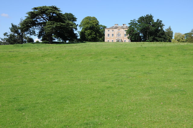
Image: © Philip Halling Taken: 16 Aug 2013
Sufton Court viewed from the approach drive to the west. The house dates from around 1790 and its design is attributed to James Wyatt. The parkland surrounding the house was laid out by Humphrey Repton whose 'red book' survives.
Images are licensed for reuse under creativecommons.org/licenses/by-sa/2.0
Image Location
Latitude
52.038117
Longitude
-2.624062