No 4 Curtis Street, Belfast
Introduction
The photograph on this page of No 4 Curtis Street, Belfast by Albert Bridge as part of the Geograph project.
The Geograph project started in 2005 with the aim of publishing, organising and preserving representative images for every square kilometre of Great Britain, Ireland and the Isle of Man.

There are currently over 7.5m images from over 14,400 individuals and you can help contribute to the project by visiting https://www.geograph.org.uk
No 4 Curtis Street, Belfast
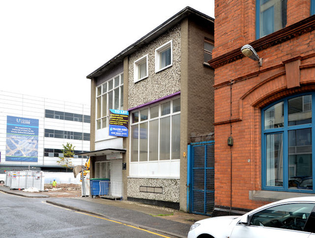
Image: © Albert Bridge Taken: 22 Aug 2013
A former Salvation Army building (latterly the Calvary Christian Centre), now vacant, at the corner of Curtis Street (foreground) and Coar’s Lane for which there is the following application for planning permission “0846/F 4 Curtis Street, Belfast Change of use of ground and first floor from ecclesiastical use to cafe/restaurant use”. This photograph appears as a matter of geographical and historical record only and does not express any opinion about the application. Continue to Image
Images are licensed for reuse under creativecommons.org/licenses/by-sa/2.0
Image Location
Latitude
54.604126
Longitude
-5.928644