Seanor Lane
Introduction
The photograph on this page of Seanor Lane by Alan Walker as part of the Geograph project.
The Geograph project started in 2005 with the aim of publishing, organising and preserving representative images for every square kilometre of Great Britain, Ireland and the Isle of Man.

There are currently over 7.5m images from over 14,400 individuals and you can help contribute to the project by visiting https://www.geograph.org.uk
Seanor Lane
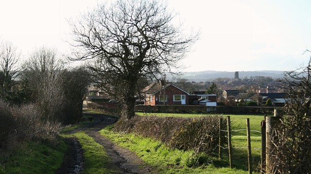
Image: © Alan Walker Taken: 6 Mar 2007
This photograph of Seanor Lane, Lower Pilsley shows the last (approximately) 120metres of the compacted stone and earth section before it joins the metalled section (ahead). From the post and wire fence (near right) there is this view of Image For a more westerly (ahead) photograph of Seanor Lane but looking back, toward this viewpoint, click here Image For a more westerly (ahead) photograph of the metalled section of Seanor Lane, click here Image Behind the viewpoint Image continues eastward toward its junction with a bridleway that leads on to the Five Pits Lane at Timber Lane.
Images are licensed for reuse under creativecommons.org/licenses/by-sa/2.0
Image Location
Latitude
53.171309
Longitude
-1.378233