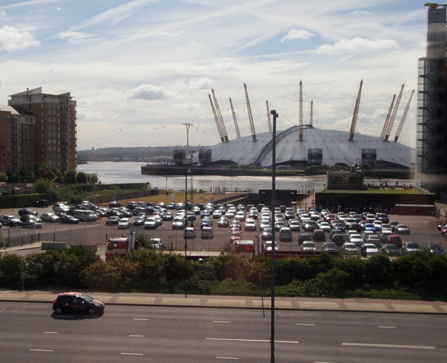
Blackwall Point, River Thames, London
Introduction
The photograph on this page of Blackwall Point, River Thames, London by David Hallam-Jones as part of the Geograph project.
The Geograph project started in 2005 with the aim of publishing, organising and preserving representative images for every square kilometre of Great Britain, Ireland and the Isle of Man.
There are currently over 7.5m images from over 14,400 individuals and you can help contribute to the project by visiting https://www.geograph.org.uk

Image: © David Hallam-Jones Taken: 13 Aug 2013
The O2 Arena with the River Thames curling round the south-east edge of Blackwall Point (a navigational point). The tall building on the right is in John Julius Close and the block on the left is off Newport Avenue. The former Grade II-listed "Blackwall Engineering Co." dry dock can be made out in the centre of the picture beyond the parked cars. This was part of a shipyard for over 350 years. It closed in 1987. The car at the front of the picture is travelling along Aspen Way (the A1261 towards central London).

