Lower Common (2)
Introduction
The photograph on this page of Lower Common (2) by Simon Carey as part of the Geograph project.
The Geograph project started in 2005 with the aim of publishing, organising and preserving representative images for every square kilometre of Great Britain, Ireland and the Isle of Man.

There are currently over 7.5m images from over 14,400 individuals and you can help contribute to the project by visiting https://www.geograph.org.uk
Lower Common (2)
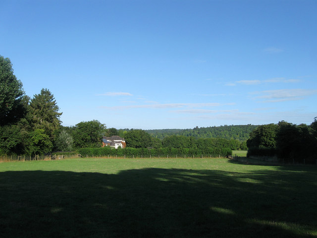
Image: © Simon Carey Taken: 19 Aug 2013
The name of the field according to Warningcamp's 1840 tithe map viewed from Burpham Road. A former medieval open field that survived up to its enclosure in 1812 it was initially divided into two large fields with the larger one seeing the construction of a number of dwellings from the 1860s onwards. One of those in view in the distance was Sefton Place which remained a family home until the 1920s when it briefly became a Roman Catholic prep school, an officer's quarters during the Second World War then a youth hostel in 1946. The hostel was closed in 2012 one of 8 closed and sold by the Youth Hostel Association in 2011. It is scheduled to be reopened as the Sussex Heritage Centre.
Images are licensed for reuse under creativecommons.org/licenses/by-sa/2.0
Image Location
Latitude
50.857248
Longitude
-0.533021