Warningcamp House
Introduction
The photograph on this page of Warningcamp House by Simon Carey as part of the Geograph project.
The Geograph project started in 2005 with the aim of publishing, organising and preserving representative images for every square kilometre of Great Britain, Ireland and the Isle of Man.

There are currently over 7.5m images from over 14,400 individuals and you can help contribute to the project by visiting https://www.geograph.org.uk
Warningcamp House
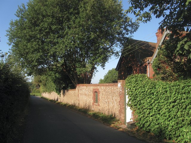
Image: © Simon Carey Taken: 19 Aug 2013
Viewed from Burpham Road the house was built in the 1860s on a plot on a former common field. Originally known as Woodleighs House it acquired its current name in the 1950s. The road in view was added in 1883 to give villagers in Burpham and Wepham a more direct route to the market town of Arundel.
Images are licensed for reuse under creativecommons.org/licenses/by-sa/2.0
Image Location
Latitude
50.856247
Longitude
-0.532058