Crannyfield Park, Omagh
Introduction
The photograph on this page of Crannyfield Park, Omagh by Kenneth Allen as part of the Geograph project.
The Geograph project started in 2005 with the aim of publishing, organising and preserving representative images for every square kilometre of Great Britain, Ireland and the Isle of Man.

There are currently over 7.5m images from over 14,400 individuals and you can help contribute to the project by visiting https://www.geograph.org.uk
Crannyfield Park, Omagh
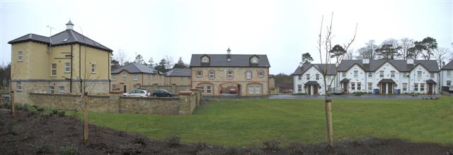
Image: © Kenneth Allen Taken: 11 Mar 2007
A view to the south, the building on the left and the one in the middle with the through-way are traditional cavity wall construction. All the rest of the properties are timber framed.
Images are licensed for reuse under creativecommons.org/licenses/by-sa/2.0
Image Location
Latitude
54.595838
Longitude
-7.268975