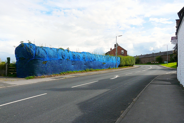
Blue hedge, Durdar Road
Introduction
The photograph on this page of Blue hedge, Durdar Road by Rose and Trev Clough as part of the Geograph project.
The Geograph project started in 2005 with the aim of publishing, organising and preserving representative images for every square kilometre of Great Britain, Ireland and the Isle of Man.
There are currently over 7.5m images from over 14,400 individuals and you can help contribute to the project by visiting https://www.geograph.org.uk

Image: © Rose and Trev Clough Taken: 12 Aug 2013
In autumn 2012 a planning application was made for a new housing estate, on fields behind the hedge. It includes creation of an access road at this spot. Presumably the netting was installed in late winter, to stop birds nesting in the hedge. If planning permission is granted before the end of the breeding season, work can proceed without delay because the hedge should contain no active nests. Information about the reasons for netting hedges can be found on these contractors websites: http://www.emec-ecology.co.uk/downloads/Hedgerow%20Netting%20Information.pdf and http://www.bird-proofing.com/hedgerow-netting.php .

