Tramway Bridge
Introduction
The photograph on this page of Tramway Bridge by David Stowell as part of the Geograph project.
The Geograph project started in 2005 with the aim of publishing, organising and preserving representative images for every square kilometre of Great Britain, Ireland and the Isle of Man.

There are currently over 7.5m images from over 14,400 individuals and you can help contribute to the project by visiting https://www.geograph.org.uk
Tramway Bridge
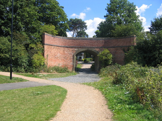
Image: © David Stowell Taken: 7 Aug 2005
This bridge used to carry the horse drawn tramway from Stratford upon Avon to Moreton in Marsh and Shipston on Stour. The GWR converted the Moreton in Marsh to Shipston on Stour sections into a "conventional" steam railway by 1889. Occasional horse drawn traffic, mainly for the carriage of lime, continued on this length from Longdon Road to Stratford upon Avon; however the line gradually became derelict. It was briefly cleared and inspected in 1904 with a view to refurbishment; however, the rails were finally lifted in 1918 to provide scrap for the war effort. The Longdon Road - Stratford upon Avon section was finally formally abandoned in the GWR Act of 1926, exactly 100 years after the line opened. The line ran mainly beside the road and through open countryside and most of the route can still be followed today. As well as the tramway bridge in Stratford Image and roadside sections such as Image there are locations where the original stone block "sleepers" can still be seen Image
Images are licensed for reuse under creativecommons.org/licenses/by-sa/2.0
Image Location


Leaflet Map data © OpenStreetMap
Latitude
52.18477
Longitude
-1.701576